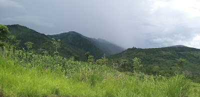
About this place
Jiribam lies on the Jiri river at Manipur's western edge, in flat, humid, distinctly Barak-valley country that feels closer to Assam than to Imphal. It is the state's rail head and holds the Dashavatar temple site at Kalinagar along with riverside villages of Manipuri Bengali and Hmar communities.
How to reach
220 km west of Imphal on NH-37, a 7–9 hour drive depending on road conditions; also reachable by rail from Silchar in Assam.
Local tips
- The NH-37 drive is long and landslide-prone in monsoon; start very early or fly to Silchar.
- Check current advisories for the western corridor before travelling.
- Accommodation is basic; book ahead rather than arriving and looking.
Gallery
On the map
Jiribam town, Jiribam district · 24.8000°N, 93.1167°E
Jiribam
Jiribam town, Jiribam district
24.8000°N, 93.1167°E
Nearby places
Within an easy detour of Jiribam.
Photo: Kc Crypto / Google Maps
WaterfallChandel
Bro Waterfall
Chandel district
Chandel's waterfall, on the road to the Myanmar border
- Distance from Imphal
- 55 km from Imphal
- Time to allow
- 2 hrs
Entry: Entry details on page
Photo: Aleng Th Gangte / Google Maps
HeritageUkhrul
Longpi (Nungbi) Black Pottery Village
Nungbi
Longpi Khullen and Longpi Kajui, Ukhrul district
Pottery made from crushed serpentine stone, without a wheel
- Distance from Imphal
- 62 km from Imphal
- Time to allow
- 2 hrs
Entry: Entry details on page
LakeTamenglong
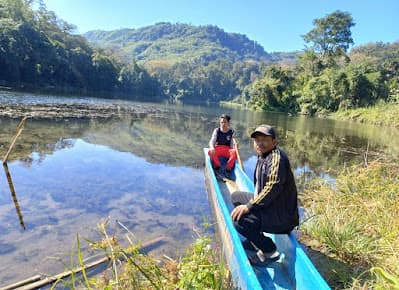
Zeilad Lake
Zeilad Wildlife Sanctuary, Tamenglong district
A chain of sacred lakes with an old python legend
- Distance from Imphal
- 175 km from Imphal
- Time to allow
- 4 hrs
Entry: Free entry
Photo: IRON HORSE Rajiv Sen / Google Maps
CaveBishnupur
Khoupum Cave
MF8H+JXV, Tamenglong, Manipur 795126, India
Corroborates the Khukdai cave named in the Khoupum Valley record in places.json.
- Distance from Imphal
- 49 km from Imphal
- Time to allow
- 2 hrs
Entry: Entry details on page